
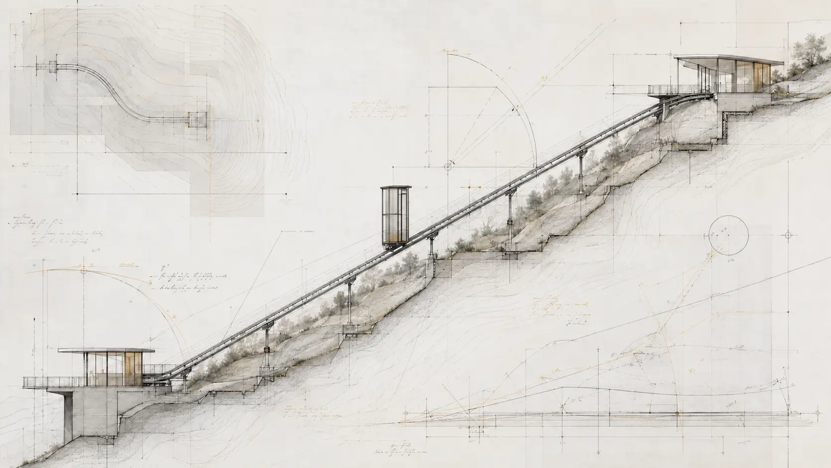
Geometry is more than a gradient percentage
Vertical rise divided by horizontal distance gives a useful first indicator, but a real hillside includes changing gradients, terraces and obstacles. The useful line may not be the steepest or shortest. It must connect the right places and leave space for stations and access.
A topographic survey shows finished levels and route changes. The online slope calculator illustrates geometry only; it does not prove feasibility or define equipment characteristics.
Ground and structures need competent design
Tracks and stations transfer loads to foundations or existing construction. Ground conditions, retaining walls and old structures need investigation appropriate to the project. F. Labbé coordinates the interfaces within its scope with the appointed structural and geotechnical professionals.
Assumptions should be visible on the drawings. If excavation reveals a service or foundation not recorded in the survey, the effect is assessed before the route is modified.
Water can determine whether details remain durable
Rain travels quickly on a slope and can collect at a station threshold or track support. Roofs, channels, drains and surrounding surfaces should form a coherent water strategy. The equipment cannot compensate for an unresolved site drainage problem.
Coastal exposure, frost and snow add different requirements. Materials and finishes are selected with maintenance and the local environment in mind rather than through a universal exterior specification.
Construction access must be designed
Every part needs to reach the site. Road width, turning area, crane position and temporary storage influence module size and assembly sequence. On occupied sites, safe routes for residents and workers also need planning.
Architects and contractors should avoid closing access or completing fragile finishes before installation operations. A logistics drawing can prevent major changes later.
Stations affect buildings and landscape
A lower station may meet a driveway; an upper station may cut into a terrace or façade. Door swings, floor levels, balustrades and waterproofing cross several trade packages. These boundaries should be drawn and assigned early.
Planting can soften the route but must preserve clearances, visibility and technical access as it grows. The landscape plan is therefore part of long-term operation.
The constraints become a project checklist
A good feasibility file records what is known, what is assumed and who will verify each open point. It covers survey, ground, structures, utilities, drainage, access, planning, use and maintenance.
This checklist does not make a complex site simple. It makes the complexity manageable and allows a bespoke outdoor inclined lift to be developed with evidence instead of optimistic guesswork.
Choose a survey scope that answers design questions
A useful topographic survey includes more than two spot levels. It records the ground along possible routes, terrace edges, walls, buildings, access roads, significant trees and visible services. Finished floor levels at intended stations are particularly valuable. The project team should agree the coordinate and level reference so that separate drawings align.
Survey accuracy and extent should match the next decision. Early photographs and approximate measurements can qualify a request, while preliminary and detailed design require reliable data. Commissioning the right information at the right time avoids both false precision and repeated work.
Investigate retaining walls and buried conditions
Many hillside properties are made of successive retaining structures built at different times. Their drawings may be incomplete, and their foundations may occupy the proposed route. A structural engineer determines what evidence is needed before new loads or openings are accepted. Where ground stability is uncertain, geotechnical advice informs the foundation strategy.
Buried drainage and utility routes also matter. Excavation near unknown services can interrupt the property and force changes to supports or stations. Available records, detection and carefully planned opening-up reduce this risk before fabrication depends on a fixed geometry.
Allow space around the moving installation
The visible cabin footprint is not the full space required. The travel path needs appropriate clearances, protective arrangements and access according to the designed system. Station doors, maintenance routes and surrounding paths also occupy space. A concept squeezed tightly between a wall and boundary may not survive detailed review.
This space should be shown on architect and landscape drawings. Planting, gates and furniture can then be arranged around a realistic envelope rather than moved after completion. On a shared or public site, the approaches may also need waiting and circulation areas.
Study water from the whole catchment
A track may cross a slope that collects water from roofs, terraces and land above. Treating only the equipment surfaces can leave major flows unresolved. The civil or landscape water strategy should identify where runoff is intercepted, conveyed and discharged without damaging foundations or station thresholds.
Maintenance is part of that strategy. Channels and outlets need to remain accessible for cleaning, and planting should not conceal recurring problems. If an existing property already shows erosion or flooding, the inclined-lift project should not assume that condition will disappear.
Check planning, neighbour and visual constraints
A new line across a garden can be visible from neighbouring land or a public viewpoint. Station roofs may affect height or façade rules, and work near boundaries may require specific procedures. The local architect or adviser identifies the applicable planning and property questions.
Visual studies help test the design from relevant points. They should show realistic track, supports and vegetation rather than using dense planting to hide unresolved mass. Honest images allow the owner and reviewing parties to discuss the real proposal.
Develop a credible installation route
Equipment cannot be teleported onto the slope. The logistics study records transport vehicle limits, unloading, crane or lifting positions, module paths and temporary storage. It also notes overhead lines, trees, gates and road restrictions. International projects add border, freight and local handling considerations.
This study feeds the fabrication design. Large parts may be divided into modules when access demands it, but every joint and lifting operation has engineering, programme and finish consequences. Resolving those choices in advance is faster and safer than improvising on site.
Record every constraint in a live coordination document
Constraints change as the design develops. A live schedule can list the issue, current assumption, responsible party, required evidence and target decision date. Survey, structure, planning, utilities, drainage, access, architecture and maintenance become manageable workstreams rather than a collection of informal concerns.
The schedule also protects the project from silent decisions. When an assumption is replaced by verified information, affected drawings and costs can be updated. F. Labbé, the architect and local contractors then work from the same current basis.
Test alternative station positions before committing
Moving a station can change more than route length. It may avoid a retaining wall, improve road access or reduce impact on a principal view. It can also create a longer pedestrian approach or conflict with a bedroom terrace. Alternative positions should be scored against service, architecture, structures, logistics and planning rather than judged on one criterion.
This comparison is most economical at concept stage. Once foundations and cabin interfaces are detailed, moving an arrival can invalidate several packages. Early option studies are therefore productive engineering, not unnecessary drawing.
Coordinate utilities before surfaces are closed
Power and communication routes may pass through buildings, gardens or retaining structures. Their destination and protection need agreement with the electrical and building contractors. Leaving a generic cable allowance without a route can produce visible surface work or excavation through completed landscape.
Existing services are also mapped where possible. The project should state which detections or opening-up are needed and who owns the risk of unidentified utilities. Clear coordination reduces disruption during installation.
Consider construction noise, access and neighbours
Hillside work can be close to adjoining villas or occupied apartments. Excavation, deliveries and lifting may need agreed hours and temporary access arrangements. The project manager coordinates these site obligations with local rules and neighbour communication.
A technically feasible line can still be a poor project if its construction method is impossible within the occupied context. Including logistics and temporary effects in option selection supports a more realistic route and programme.
Close feasibility with a clear basis of design
At the end of feasibility, the team should have a preferred route, intended use, principal station positions, known interfaces, key constraints and a list of further evidence. The document should state which drawings are indicative and which information has been surveyed.
This basis allows preliminary design and budgeting to proceed without repeating the same strategic debate. It does not remove uncertainty; it gives uncertainty a responsible owner and next action.
Use the constraint review to improve the design
Constraints are not only obstacles. A retaining wall can guide the route, an existing terrace can become a natural station and a limited crane position can encourage a clear modular assembly strategy. The design team should look for these productive relationships while remaining honest about additional work and risk.
The final concept is stronger when it responds visibly to the site rather than appearing to fight it. A documented constraint review gives the architect and owner reasons for the chosen alignment and helps later contractors understand which conditions must be preserved. That record remains useful throughout construction.